Data offers
Local/Regional:
The federal states and cities are often active in the Open Data movement, - for example: Hamburg, Berlin, Brandenburg, Nordrhein-Westfalen, Thüringen, Rheinland-Pfalz; as well as individul cities like - the Aachen, Bonn, Dresden, Köln, Moers und Rostock (an list can be found in OpenGeoEdu-Datenportal).
National:
The national actors, such as the Federal Office for Cartography and Geodesy (BKG) or the Federal Statistical Office (DESTATIS), provide open geobasis and statistical data - from land use data to building and traffic data. Nevertheless, there are several types of user licenses, services and data qualities available.
International:
Data are provided in particular by the European Statistical Office (Eurostat), the European Environment Agency (EEA), the Organisation for Economic Cooperation and Development (OECD) and geoportals of other European Union (EU) countries. These include, for example, the data products of Copernicus (Urban Atlas). In addition, worldwide data offers exist such as Flickr, OpenStreetMap (OSM), Global Human Settlement Layer (GHSL), Global Urban Footprint (GUF), "Nighttime Imagery", elevation models and other products based on Volunteered Geographic Information (VGI).
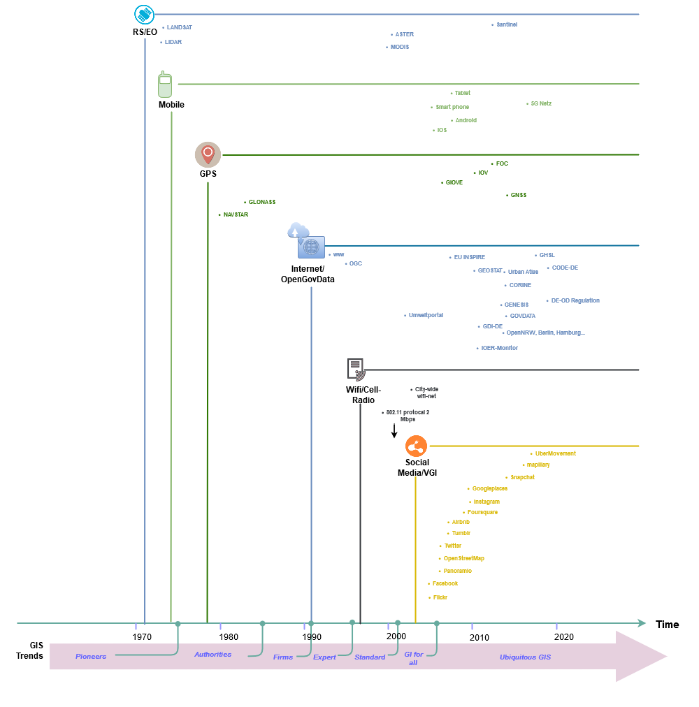
Figure: Development of important data sources and technologies after selection. (Source: Own representation according to Ilieva & McPhearson, 2018. p. 556; Bill, 2018)
