Application of geometric methods for vector data
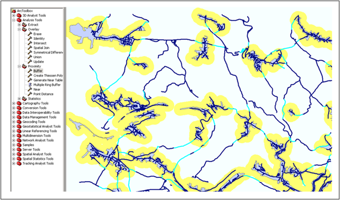
For this example, the scenario of an animal disease outbreak is assumed. Now a 300 m protection zone is to be established around the rural settlements. In addition, all road sections crossing the edge of the protection zones are to be marked in order to find the road sections on which access areas or barriers may have to be built more quickly. The following figure shows the result of such an analysis: The protection zones are calculated and represented as contiguous zones (buffers) around the settlement areas. The road sections are then geometrically intersected with these zones and the sections that intersect the edge of the zones have been selected.

Application of zoning and intersection for the determination of protection zones and road sections to be blocked
