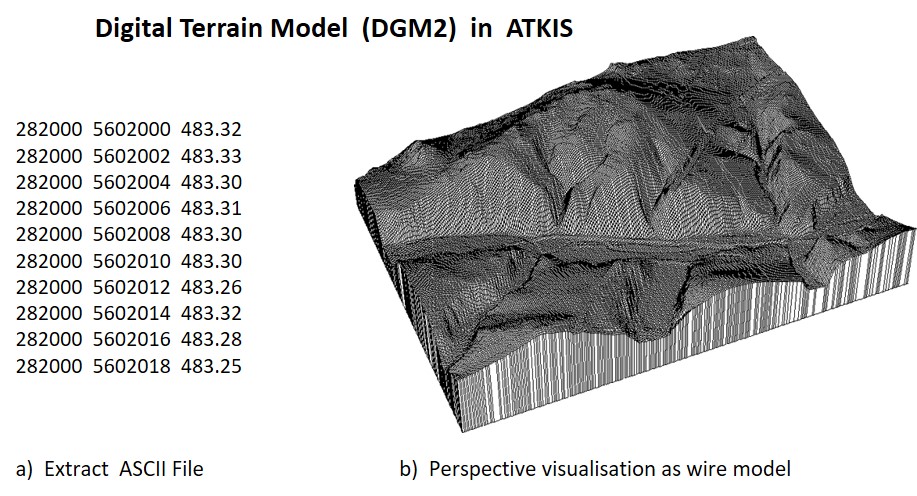
Example ATKIS - Digital terrain model as field-based model
The Digital Terrain Model (DTM) of the Official Topographic-Cartographic Information System for the description of the relief (Elevation) is a prominent example of field-based modeling. Points on a regular grid are assigned height values, and from this grid a representation of the terrain surface (e.g. by spatial interpolation) can be derived (see figure).

Excerpts from the Digital Terrain Model in ATKIS. Source: GeoSN; http://www.landesvermessung.sachsen.de/inhalt/produkte/dhm/DTM/DTM_detail.html (accessed May 2014).
