Urban green
City trees and green spaces
As described, the distribution of the forests is well documented and can be derived with high spatial accuracy. Trees are an essential component in the global scale of the complex forest ecosystem. But also at the local level, outside forests, they are of great importance in the urban context and assume important functions. Within cities (e.g. parks, street greening) they contribute both to improving local recreation and air quality and play a decisive role for the urban climate through cooling.

The positive properties of city trees and vegetation is only one aspect. In addition to the mere existence of (urban) green spaces, free access to them and accessibility on foot or by bicycle (e.g. Tietz 2018) is an important factor for an increased quality of life. This is the only way to ensure adequate local recreation. The White Paper "Stadtgrün" (2017) of the Federal Ministry for Environment, Nature Conservation, Construction and Nuclear Safety (BMUB) (since 2018 again: Federal Ministry for the Environment, Nature Conservation and Nuclear Safety, BMU) addresses the importance of urban green spaces. At this point, reference should also be made to the course section on land use monitoring, which also deals with urban green areas.
Changes in land cover and land use as well as constant soil sealing are ongoing issues. These changes do not only occur in rural regions. The sealing of open spaces and green spaces plays a particularly important role in urban areas. In addition, however, new parks and green spaces can be created or redesigned to optimise the local urban climate. The causes can be manifold, especially when we talk about sealing. In addition to will and skill in planning, the pressure of a growing population and local market and socio-economic conditions are decisive factors. In our practical remote sensing exercises, you can go through exercises on urban trees and urban green.
The survey of trees in cities
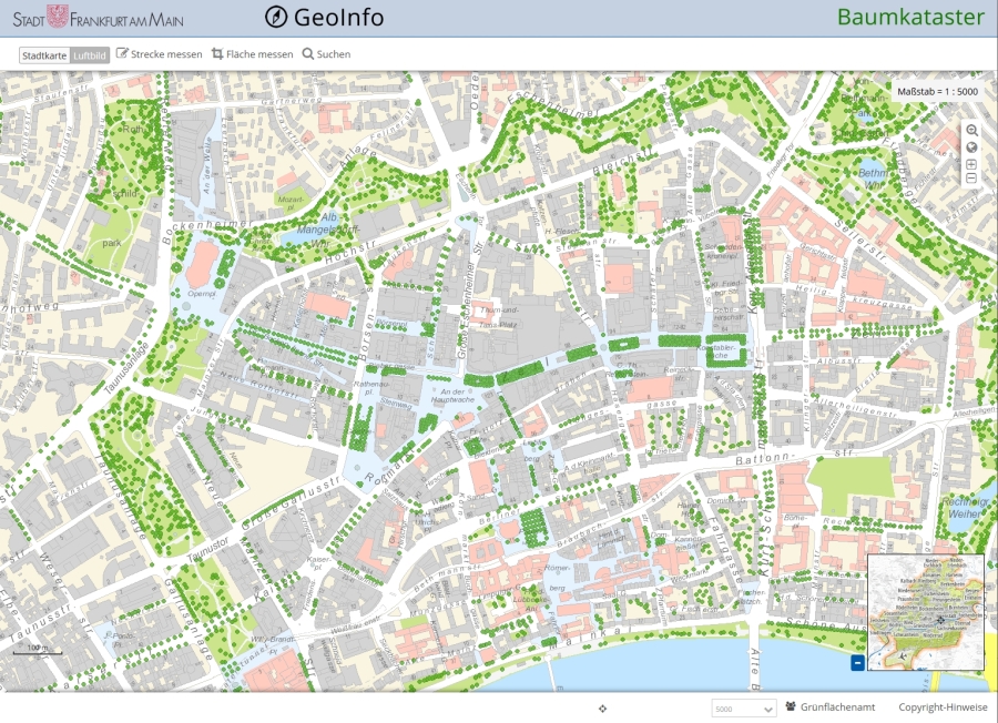
In many cities and municipalities, all trees (in public spaces) are registered in a tree register. In addition to the exact position, various attributes such as tree species, height and diameter of trunk and crown, or health status are recorded..

Tree cadastre of the city of Frankfurt (Main), Grünflächenamt Frankfurt, https://geoinfo.frankfurt.de/mapbender/application/baumkataster
Some German cities now offer free access to their tree cadastres. Examples are Rostock (opendata-hro.de), Leipzig (opendata.leipzig.de), Frankfurt (offenedaten.frankfurt.de), Hamburg (transparenz.hamburg.de), Berlin (stadtentwicklung.berlin.de), Bonn (opendata.bonn.de) and Cologne (offenedaten-koeln.de). Esri Germany also offers some of these data sets on the ArcGIS Open Data pages to download.
However, the registration of trees within urban areas is a different situation than in open country. Areas and individual trees are often scattered and the building and infrastructure influences the registration. Up-to-date information is needed that is difficult to capture in-situ on a large scale. In order to obtain a quick overview of the forest and green areas on a large scale and to observe the health of the vegetation, remote sensing with a view from above is used. Addressing urban vegetation is also a topic in a task that you can go through as part of our practical exercise.
In this context, reference should be made to a study carried out by the Berliner Morgenpost 2016 in cooperation with the TU Berlin and the University of Freiburg. The team investigated the question of which is the "greenest city" in Germany and used Landsat satellite images, among others.
