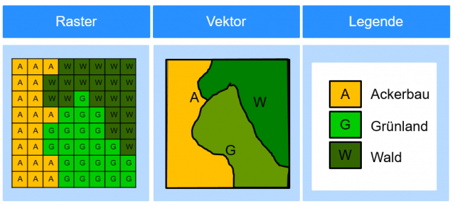
Comparison of vector and raster data
In summary, vector data, especially on a smaller scale, can be considered more accurate (see Fig. 11). However, these are often not available or can be incomplete. Raster data are usually complete, but they depend on their pixel size. If the pixel size is too high, deviations or errors in the results must be expected.
Fig. 11: Comparison of raster and vector data
Due to the accessibility of the raster data, they are often used as a basis for the calculation of landscape structures. However, vector data, if available, should be preferred.
